The Campground at NSA Annapolis
Military campground (Navy) on Naval Support Activity Annapolis, near Annapolis, Maryland. Not open to the general public: see who can use military campgrounds.
Facts from the official page
- Sites
- 14 RV pads (30 × 50 ft concrete) with picnic table and charcoal grill; shared primitive tent areas. Bathhouse with hot showers and dump station. Pet-friendly. Wooded and on the water. source
- Hookups
- 30 A and 20 A electric outlets. source
- Eligibility (as listed)
- Active duty, retirees, reserve component, DoW civilians, 100% service-connected disabled veterans, Purple Heart recipients, former POWs, all veterans with a service-connected disability, VA PCAFC primary caregivers, Medal of Honor recipients, and certain surviving and former spouses. Guests as determined by the commanding officer. source
- Reservations
- 1-877-NAVY-BED. source
Unverified, call ahead
- Rates are not published on the page.
- Water hookups at RV pads are not stated.
- Base access steps for non-ID-card holders are not on the page; call ahead.
We could not confirm these on an official page, so we leave them blank rather than guess. Call 1-877-628-9233.
If you don't have a DoD ID card
Under the 2020 expanded-access rule (32 CFR 225.4), veterans with a VA service-connected disability rating, Purple Heart recipients, former POWs and VA-designated primary family caregivers may use MWR recreational lodging and RV campgrounds. To get on a base, enroll at the installation's visitor center on your first visit, using a VHIC or REAL ID and passing an on-the-spot background check. At check-in, show a VHIC that lists your eligibility status, or a VA letter plus REAL ID. Guests can travel with you but must clear the visitor center themselves (DoD transition plan, Feb 2026).
Full guide: who can use military campgrounds →
Map: trails and roads nearby
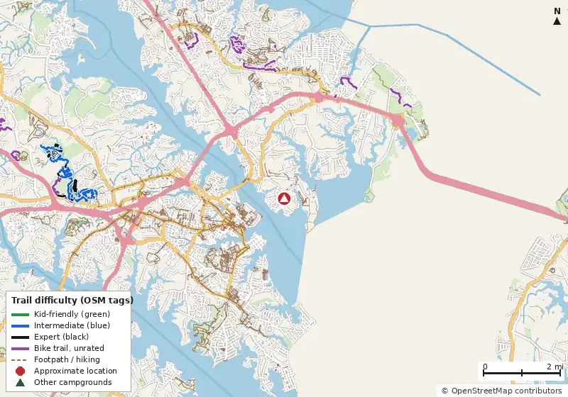
Loads MapLibre with OpenFreeMap tiles only when you tap.
Trails nearby (from our data)
9.3 miles of bike-legal trail are mapped in OpenStreetMap within 5 miles of the pin; 0.4 mi carry a difficulty tag. Some may be on the installation and closed to visitors.
| Trail | Closest point | Miles within 5 mi | Difficulty (as tagged) |
|---|---|---|---|
| Pine Hill Path | 4.0 mi | 0.3 | Unrated |
| Shack | 4.0 mi | 0.5 | Unrated |
| Cars | 4.1 mi | 0.3 | Unrated |
| Flownation | 4.1 mi | 0.2 | Unrated |
| Carwash | 4.1 mi | 0.2 | Unrated |
| Kimwood Farm Trail | 4.2 mi | 0.2 | Unrated |
| Forked Creek Main Loop | 4.2 mi | 0.1 | Unrated |
| Turtle Run | 4.2 mi | 0.3 | Unrated |
| Frog Hollow | 4.2 mi | 0.3 | Unrated |
| Alligator's Wedge | 4.2 mi | 0.1 | Unrated |
Ratings come only from OpenStreetMap mtb:scale and IMBA tags. Untagged trails show as unrated; we never guess.
Public campgrounds nearby
These are open to everyone, in case you aren't eligible or the military campground is full.
| Campground | Miles | State | Fee/night | Sites | Hookups | Max RV | Pets | Booking | Trails ≤5 mi |
|---|---|---|---|---|---|---|---|---|---|
| Pine Tree Associates OpenStreetMap listing |
7.6 | MD | — | — | — | — | — | ? | 0 |
| Washington DC / Capitol KOA Holiday Cabins KOA |
11.3 | MD | — | — | E | yes | — | Reserve | 0 |
| Ford Campsite at Stocketts Run Anne Arundel County |
13.4 | MD | $10 | — | — | — | — | ? | 0 |
| Bay Shore Campground Private campground |
14.5 | MD | — | — | E | yes | — | ? | 0 |
| Adventure Bound Washington DC Adventure Bound Camping Resorts |
17.1 | MD | — | — | E | yes | — | Reserve | 0 |
| Watkins Regional Park Maryland-National Capital Park and Planning Commission |
18.6 | MD | — | — | — | — | — | ? | 0 |
Hookups: E = electric (max amps), W = water, S = sewer. "—" means the agency doesn't publish it. Trail counts are named USFS/NPS trails within 5 miles. 🟢 = kid-friendly (green-rated) bike trail nearby.