Parksville Lake rv Campground
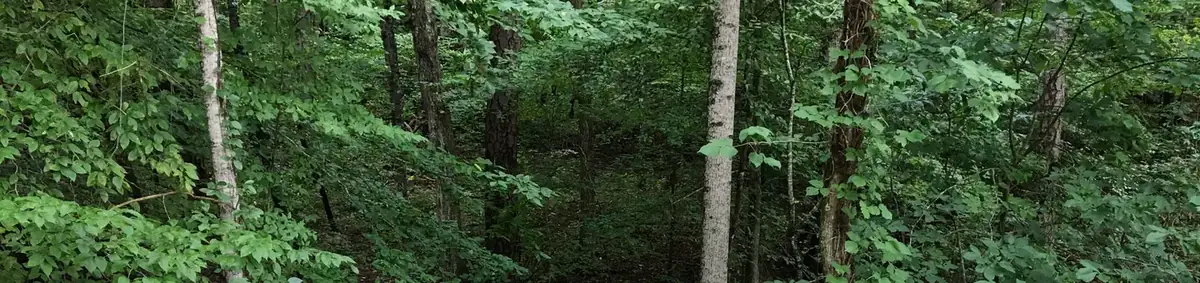
USDA Forest Service campground in Cherokee National Forest, near Benton, Tennessee.
Summary
Parksville Lake rv Campground is a USDA Forest Service campground in Cherokee National Forest, about 42 miles (straight line) from Chattanooga. The campground lists 16 overnight sites (including 16 electric sites). For riders, 1.0 miles of bike-legal trail lie within 5 miles, the closest being Forest Walk (2.8 mi away). Camping is reservable on Recreation.gov, with 30-amp electric hookups available.
Amenities
- ⚡Electric hookups (30 amp)
- 🐕Pet-friendly
- ♿ADA-accessible sites
- 🔥Fire rings
- 🍖Grills
- 🪑Picnic tables
Listed only when Recreation.gov site records report it. A missing item means not reported, not necessarily absent.
Map: trails and roads near Parksville Lake rv Campground
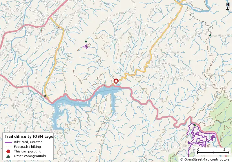
Loads MapLibre with OpenFreeMap tiles only when you tap.
How it compares
- With 16 sites it is the #40 largest of 84 Tennessee campgrounds that publish a site count.
- There are 18 other campgrounds in our data within 25 miles.
- Electric sites go up to 30 amp service (16 electric sites).
- 100% of sites with a shade rating are listed as shaded or partly shaded.
- Pets allowed on 16 of 16 sites; campfires allowed on 16 (subject to seasonal fire bans).
- Straight-line distance: Chattanooga ~42 mi, Knoxville ~69 mi, Asheville ~119 mi.
Site mix
Amenities & rules
Fire pitsGrillsLantern postsPicnic tablesPets allowedTentsRVs/trailers1 accessible site
Trails within 5 miles
| Trail | Closest point | Mapped miles within 5 mi | Source |
|---|---|---|---|
| Clemmer Bike Trail | 0.3 mi | 4.0 | USFS |
| Scenic Spur Trail | 0.3 mi | 1.6 | USFS |
| Clemmer Spur | 0.3 mi | 1.6 | USFS |
| Clear Creek Trail | 0.4 mi | 4.3 | USFS |
| Sylco Loop | 1.2 mi | 9.8 | USFS |
| Rim Rock Spur | 1.6 mi | 0.5 | USFS |
| Rim Rock Trail | 1.6 mi | 0.9 | USFS |
| Laurel Loop | 1.8 mi | 1.7 | USFS |
| Caney Creek Trail | 2.0 mi | 2.5 | USFS |
| Benton Falls Hiking Trails | 2.1 mi | 1.3 | USFS |
| Red Leaf | 2.4 mi | 0.2 | USFS |
| Slickrock Loop Bike Trail | 2.4 mi | 1.5 | USFS |
+ 8 more named trails.
Mountain biking nearby
1.0 miles of bike-legal trail lie within 5 miles. Difficulty mix: Unrated: 1.0 mi
| Trail | Closest point | Miles within 5 mi | Difficulty (as tagged) | Kids | Source |
|---|---|---|---|---|---|
| Forest Walk | 2.8 mi | 0.4 | Unrated | OSM | |
| McKamy Lake Trail | 2.9 mi | 0.6 | Unrated | OSM |
Ratings come only from OpenStreetMap mtb:scale / IMBA tags. Untagged trails show as "Unrated", and we never guess. Check conditions and maps on Trailforks or MTB Project.
Activities listed
Auto TouringBikingBoatingCampingCanoeingFire Lookouts/cabins OvernightFishingHikingHorse CampingHorseback RidingInterpretive ProgramsKayakingMountain BikingNon-motorized BoatingOff Highway VehiclePicnickingRaftingRecreational VehiclesRiver TripsSwimmingVisitor CenterWater AccessWhitewater RaftingWildlife Viewing
Nearest campgrounds
| Campground | Miles | State | Fee/night | Sites | Hookups | Max RV | Pets | Booking | Trails ≤5 mi |
|---|---|---|---|---|---|---|---|---|---|
| Chilhowee Group Camp Cherokee National Forest |
3.2 | TN | $8 | — | — | — | — | Reserve | 20 (25.9 mi) |
| Chilhowee Campground Cherokee National Forest |
3.2 | TN | — | 59 | E 50A | 90 ft | yes | Reserve | 20 (25.9 mi) |
| Ocoee RV Park Private campground |
4.6 | TN | — | — | — | — | — | ? | 19 (27.3 mi) |
| Thunder Rock Campground Cherokee National Forest |
5.8 | TN | $15–$20 | 38 | E 30A | yes | yes | Reserve | 26 (83.2 mi) |
| Sylco Campground US Forest Service |
6.1 | TN | Free | 12 | — | — | — | ? | 19 (60.3 mi) |
| Lost Creek Campground US Forest Service |
6.7 | TN | Free | 15 | — | — | — | ? | 6 (40.7 mi) |
Hookups: E = electric (max amps), W = water, S = sewer. "—" means the agency doesn't publish it. Trail counts are named USFS/NPS trails within 5 miles. 🟢 = kid-friendly (green-rated) bike trail nearby.