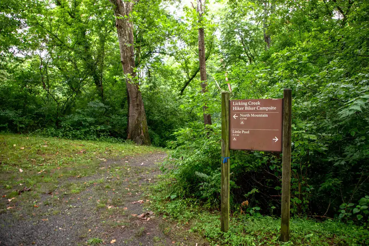
Licking Creek Hiker-Biker Campsite
National Park Service campground in Chesapeake & Ohio Canal National Historical Park, near Pool, Maryland.
Summary
Licking Creek Hiker-Biker Campsite in Chesapeake & Ohio Canal National Historical Park is about 33 miles (straight line) from Winchester; it is run by the National Park Service. Sites carry no nightly fee, according to the agency. Camping is first-come, first-served only. For riders, 37.4 miles of bike-legal trail lie within 5 miles, the closest being Chesapeake and Ohio Canal Trail (at the campground).
Map: trails and roads near Licking Creek Hiker-Biker Campsite
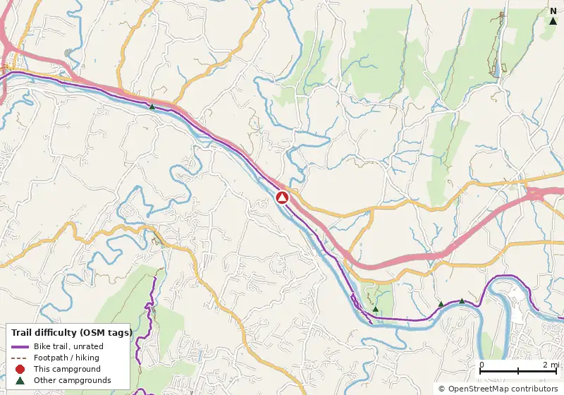
Loads MapLibre with OpenFreeMap tiles only when you tap.
How it compares
- There are 33 other campgrounds in our data within 25 miles.
- Straight-line distance: Winchester ~33 mi, Washington ~75 mi, Baltimore ~81 mi.
Amenities & rules
The agency hasn't published an amenity list for this campground.
Trails within 5 miles
| Trail | Closest point | Mapped miles within 5 mi | Source |
|---|---|---|---|
| Towpath, Milepost 116-117 (116.00) | 0.0 mi | 0.7 | NPS |
| Towpath, Milepost 115-116 (115.00) | 0.0 mi | 1.0 | NPS |
| Towpath, Milepost 117-118 (117.00) | 0.6 mi | 1.0 | NPS |
| Towpath, Milepost 114-115 (114.00) | 1.0 mi | 1.0 | NPS |
| Towpath, Milepost 118-119 (118.00) | 1.6 mi | 1.0 | NPS |
| Towpath, Milepost 113-114 (113.00) | 2.0 mi | 1.1 | NPS |
| Towpath, Milepost 119-120 (119.00) | 2.6 mi | 1.0 | NPS |
| Towpath, Milepost 112-113 (112.00) | 3.1 mi | 1.0 | NPS |
| Towpath, Milepost 120-121 (120.00) | 3.6 mi | 1.1 | NPS |
| Towpath, Milepost 111-112 (111.00) | 4.0 mi | 0.9 | NPS |
| Towpath, Milepost 121-122 (121.00) | 4.5 mi | 0.8 | NPS |
| Towpath, Milepost 110-111 (110.00) | 4.7 mi | 0.4 | NPS |
Mountain biking nearby
37.4 miles of bike-legal trail lie within 5 miles (2.4 mi on unnamed paths). Difficulty mix: Unrated: 37.4 mi
| Trail | Closest point | Miles within 5 mi | Difficulty (as tagged) | Kids | Source |
|---|---|---|---|---|---|
| Chesapeake and Ohio Canal Trail | 0.0 mi | 21.3 | Unrated | OSM | |
| Towpath, Milepost 116-117 (116.00) | 0.0 mi | 0.7 | Unrated | NPS | |
| Towpath, Milepost 115-116 (115.00) | 0.0 mi | 1.0 | Unrated | NPS | |
| Towpath, Milepost 117-118 (117.00) | 0.6 mi | 1.0 | Unrated | NPS | |
| Towpath, Milepost 114-115 (114.00) | 1.0 mi | 1.0 | Unrated | NPS | |
| Towpath, Milepost 118-119 (118.00) | 1.6 mi | 1.0 | Unrated | NPS | |
| Towpath, Milepost 113-114 (113.00) | 2.0 mi | 1.1 | Unrated | NPS | |
| Towpath, Milepost 119-120 (119.00) | 2.6 mi | 1.0 | Unrated | NPS | |
| Towpath, Milepost 112-113 (112.00) | 3.1 mi | 1.0 | Unrated | NPS | |
| Towpath, Milepost 120-121 (120.00) | 3.6 mi | 1.1 | Unrated | NPS | |
| Beaver Pond Trail | 3.7 mi | 0.7 | Unrated | OSM | |
| Tuscarora Trail | 4.0 mi | 2.0 | Unrated | OSM |
+ 3 more.
Ratings come only from OpenStreetMap mtb:scale / IMBA tags. Untagged trails show as "Unrated", and we never guess. Check conditions and maps on Trailforks or MTB Project.
Activities listed
BikingBoatingCampingFishingHikingHorseback RidingPaddlingWildlife Viewing
Nearest campgrounds
| Campground | Miles | State | Fee/night | Sites | Hookups | Max RV | Pets | Booking | Trails ≤5 mi |
|---|---|---|---|---|---|---|---|---|---|
| Fort Frederick State Park Campground Fort Frederick State Park |
3.8 | MD | $15 | — | — | — | — | Reserve | 12 (11.8 mi) |
| Little Pool Hiker-Biker Campsite Chesapeake & Ohio Canal National Historical Park |
4.2 | MD | Free | — | — | — | — | First-come | 13 (11.4 mi) |
| McCoy's Ferry Campground Chesapeake & Ohio Canal National Historical Park |
5.1 | MD | — | 13 | — | yes | yes | Reserve | 14 (13.7 mi) |
| North Mountain Hiker-Biker Campsite Chesapeake & Ohio Canal National Historical Park |
5.5 | MD | Free | — | — | — | — | First-come | 14 (13.9 mi) |
| White Rock Hiker-Biker Campsite Chesapeake & Ohio Canal National Historical Park |
8.8 | MD | Free | — | — | — | — | First-come | 14 (12.3 mi) |
| Leopards Mill Hiker-Biker Overnight (HBO) Campsite Chesapeake & Ohio Canal National Historical Park |
10.2 | MD | Free | — | — | — | — | First-come | 15 (14.8 mi) |
Hookups: E = electric (max amps), W = water, S = sewer. "—" means the agency doesn't publish it. Trail counts are named USFS/NPS trails within 5 miles. 🟢 = kid-friendly (green-rated) bike trail nearby.