Canaan Valley Resort State Park Campground
West Virginia State Parks campground in Canaan Valley Resort State Park, West Virginia.
Summary
Canaan Valley Resort State Park Campground is a West Virginia State Parks campground in West Virginia, about 50 miles (straight line) from Harrisonburg. For riders, 27.9 miles of bike-legal trail lie within 5 miles, the closest being Back Hollow Trail (0.4 mi away), including 6 expert-rated trails. Sites are booked through the state park reservation system.
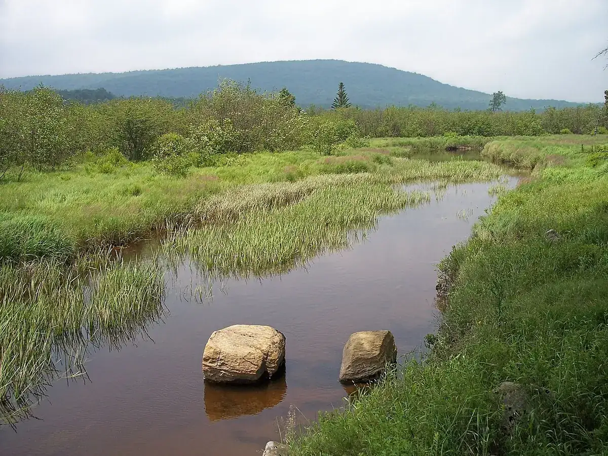
Background: It lies in the highest valley east of the Mississippi, home to one of the largest inland wetlands in the country. Established 1971. (Background: Wikipedia; year: Wikidata, restated in our own words.)
Map: trails and roads near Canaan Valley Resort State Park Campground
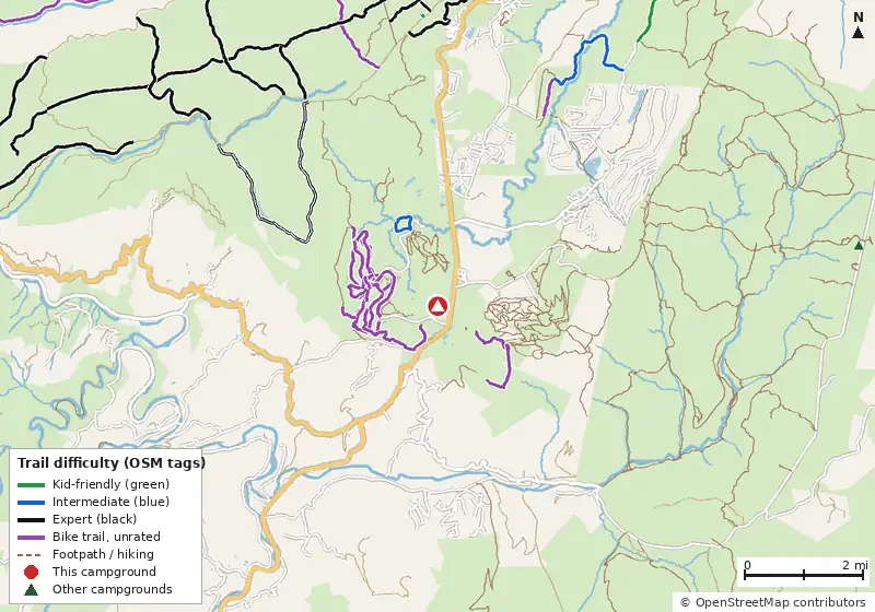
Loads MapLibre with OpenFreeMap tiles only when you tap.
How it compares
- There are 21 other campgrounds in our data within 25 miles.
- Straight-line distance: Harrisonburg ~50 mi, Winchester ~70 mi, Charlottesville ~86 mi.
Amenities & rules
The agency hasn't published an amenity list for this campground.
Trails within 5 miles
| Trail | Closest point | Mapped miles within 5 mi | Source |
|---|---|---|---|
| Pointy Knob Trail | 2.5 mi | 5.1 | USFS |
| Flatrock Run Trail | 3.1 mi | 2.7 | USFS |
| Dunkenbarger Trail | 3.3 mi | 1.5 | USFS |
| Little Stonecoal Trail | 3.3 mi | 1.3 | USFS |
| Big Stonecoal Trail | 3.7 mi | 3.9 | USFS |
| Blackbird Knob Trail | 3.7 mi | 1.8 | USFS |
| Breathed Mountain Trail | 3.7 mi | 2.4 | USFS |
| Rocky Ridge Trail | 3.8 mi | 1.8 | USFS |
| Harman Trail | 4.0 mi | 1.3 | USFS |
| Red Creek Trail | 4.1 mi | 2.9 | USFS |
| Fire Trail Number 6 | 4.2 mi | 0.8 | USFS |
| Davis | 4.2 mi | 1.0 | USFS |
+ 3 more named trails.
Mountain biking nearby
27.9 miles of bike-legal trail lie within 5 miles. Difficulty mix: Intermediate: 1.9 miExpert: 2.7 miExpert (double black): 5.1 miUnrated: 18.2 mi
| Trail | Closest point | Miles within 5 mi | Difficulty (as tagged) | Kids | Source |
|---|---|---|---|---|---|
| Back Hollow Trail | 0.4 mi | 3.1 | Unrated | OSM | |
| Bald Knob | 0.8 mi | 2.0 | Unrated | OSM | |
| Promised Land Trail | 0.9 mi | 5.2 | Unrated | OSM | |
| Three Pin | 1.0 mi | 0.3 | Unrated | OSM | |
| Middle Ridge Trail | 1.1 mi | 2.1 | Unrated | OSM | |
| Club Moss | 1.1 mi | 0.4 | Unrated | OSM | |
| Railroad Grade Trail | 1.2 mi | 1.0 | Unrated | OSM | |
| Club Run Trail | 1.2 mi | 1.1 | Unrated | OSM | |
| Bottleneck | 1.2 mi | 0.2 | Unrated | OSM | |
| Ridge Top Trail | 1.3 mi | 0.1 | Unrated | OSM | |
| Monarch Trail | 1.4 mi | 0.2 | Unrated | OSM | |
| Blackwater River Trail | 1.4 mi | 0.9 | Blue | OSM |
+ 11 more.
Ratings come only from OpenStreetMap mtb:scale / IMBA tags. Untagged trails show as "Unrated", and we never guess. Check conditions and maps on Trailforks or MTB Project.
Nearest campgrounds
| Campground | Miles | State | Fee/night | Sites | Hookups | Max RV | Pets | Booking | Trails ≤5 mi |
|---|---|---|---|---|---|---|---|---|---|
| Red Creek Campground Monongahela National Forest |
7.2 | WV | — | — | — | — | — | First-come | 19 (42.3 mi) |
| Blackwater Falls State Park Campground Blackwater Falls State Park |
7.9 | WV | See booking site | — | E | yes | — | Reserve | 11 (19.0 mi) |
| Campsite 5 OpenStreetMap listing |
8.8 | WV | — | — | — | — | — | ? | 6 (8.6 mi) |
| Yokum's Campground Private campground |
12.7 | WV | — | — | — | — | — | ? | 2 (2.7 mi) |
| Princess Snowbird Campground Private campground |
13.2 | WV | — | — | — | — | — | ? | 2 (2.7 mi) |
| Bear Heaven Campground Monongahela National Forest |
13.8 | WV | — | — | — | — | — | First-come | 10 (27.1 mi) |
Hookups: E = electric (max amps), W = water, S = sewer. "—" means the agency doesn't publish it. Trail counts are named USFS/NPS trails within 5 miles. 🟢 = kid-friendly (green-rated) bike trail nearby.